DeepMapping2  

Self-Supervised Large-Scale LiDAR Map Optimization

CVPR 2023

1New York University, Brooklyn, NY 11201, USA
2University of Rochester, Rochester, NY 14627, USA

KITTI_0018

KITTI_0027

NCLT

NeBula

Mapping result on the KITTI, NCLT, and NeBula dataset. The bird's eye view map is shown together with the estimated sensor pose of each frame. Each pose is represented by an arrow indicating the xy-coordinate and heading (yaw angle) as shown in the bottom examples.


Abstract

LiDAR mapping is important yet challenging in self-driving and mobile robotics. 
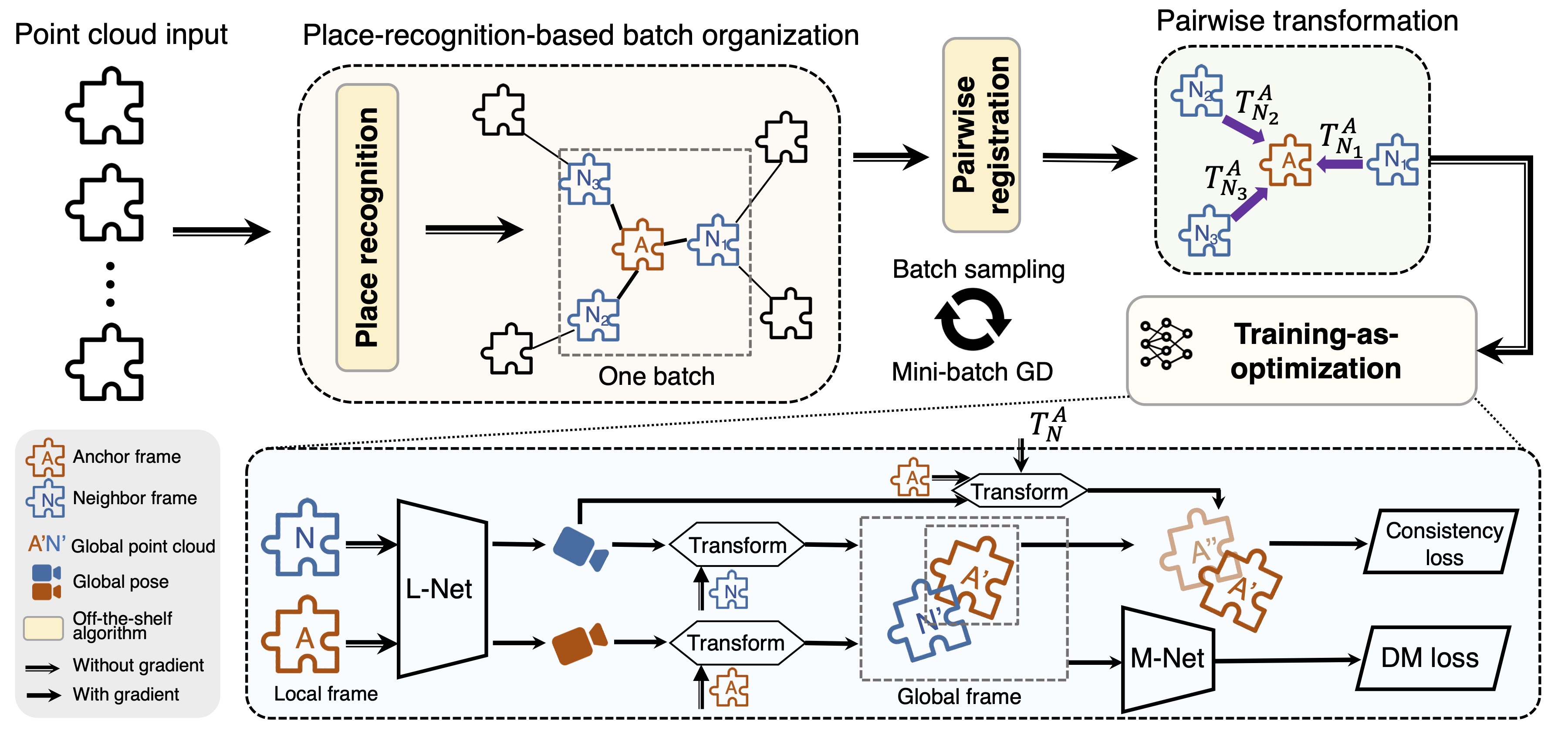
To tackle such a global point cloud registration problem, DeepMapping converts the complex map estimation into a self-supervised training of simple deep networks.

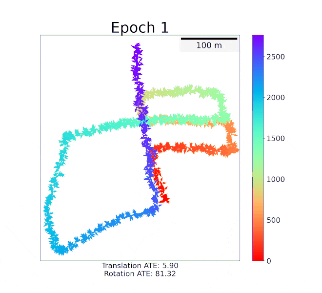
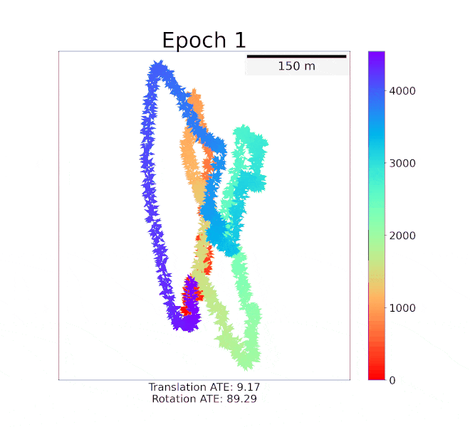
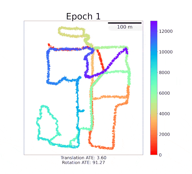
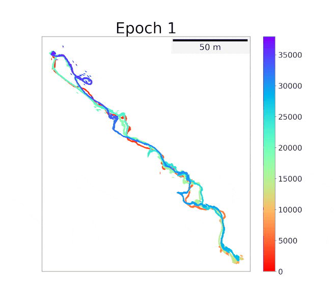
Despite its broad convergence range on small datasets, DeepMapping still cannot produce satisfactory results on large-scale datasets with thousands of frames. This is due to the lack of loop closures and exact cross-frame point correspondences, and the slow convergence of its global localization network.

We propose DeepMapping2 by adding two novel techniques to address these issues:

  • organization of training batch based on map topology from loop closing
  • self-supervised local-to-global point consistency loss leveraging pairwise registration.
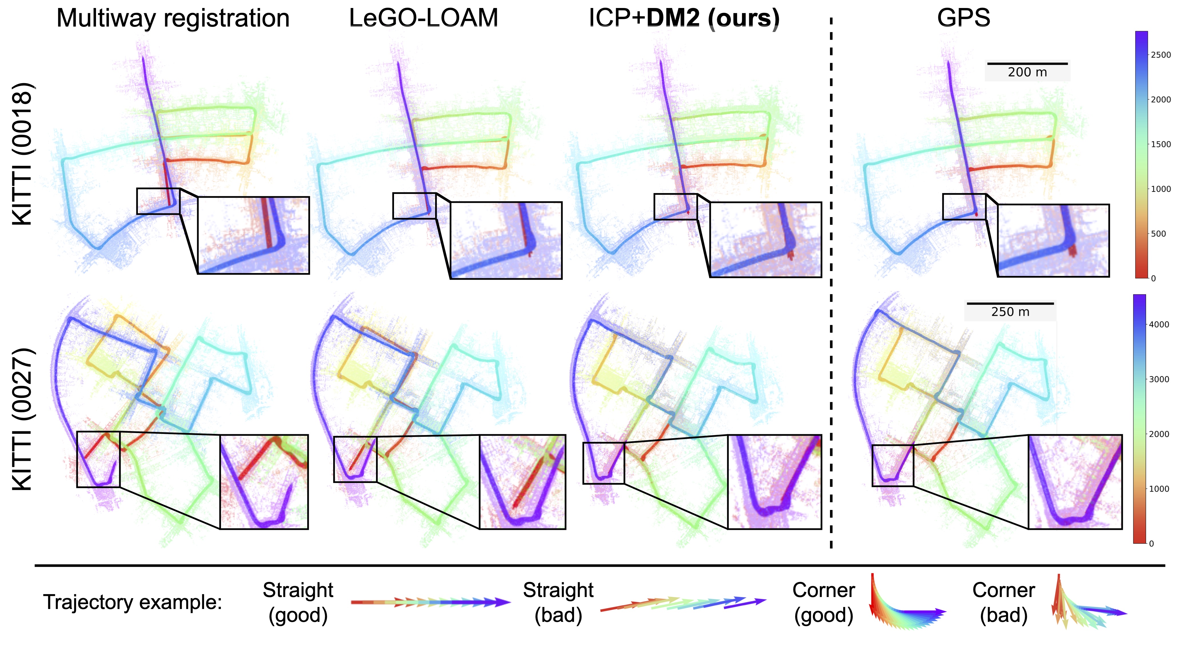
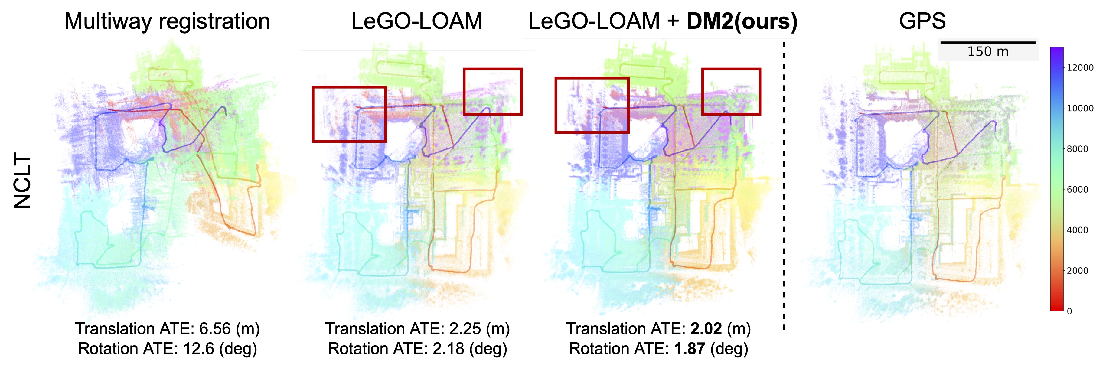
  • Our experiments and ablation studies on public datasets (KITTI, NCLT, and Nebula) demonstrate the effectiveness of our method. Our code will be released.

  • Method


    Pipeline of DeepMapping2. The pipeline mainly consists of place-recognition-based batch organization and learning-based optimization. In batch organization, the input point clouds are organized into mini-batches by topological map attained from place recognition. Each batch contains an anchor frame and several spatially closed neighbor frames. The transformation between the anchor frame and each neighbor frame is obtained by pairwise registration. In optimization, each batch is fed into L-Net to estimate the global pose. The transformed global anchor frame is then obtained in two ways: directly from the global pose of the anchor frame and from the global pose of the neighbor frame and the pairwise registration.


    Mapping results


    NeBula dataset. The above is the map from kinematic odometry (KO) and below is from KO+DeepMapping2.


    Trajectory error


    Heat map for ATEs. The trajectory error of each frame is illustrated by color, with blue indicating the lowest error and red indicating the highest error. The red box highlights the regions where DeepMapping2 improves over LeGO-LOAM.

    BibTeX

    
          @article{chen2022deepmapping2,
            title={DeepMapping2: Self-Supervised Large-Scale LiDAR Map Optimization},
            author={Chen, Chao and Liu, Xinhao and Li, Yiming and Ding, Li and Feng, Chen},
            journal={arXiv preprint arXiv:2212.06331},
            year={2022}
          }
        

    Acknowledgements

    Chen Feng is the corresponding author. The research is supported by NSF Future Manufacturing program under CMMI-1932187, CNS-2121391, and EEC-2036870. Chao Chen gratefully thanks the help from Pratyaksh P. Rao and Pareese Pathak.